The breathtaking scenery that can be viewed as far as the eye can see will refresh and renew your spirit and give you renewed energy. Feel mother nature’s breath as you take your first steps into this wonderful natural world.
Experience the Sea of Japan’s Waters and Skies
Because the Kirakira Uetsu Tourism Area faces the Sea of Japan, there are tons of activities that let you enjoy the beautiful blue waters and skies of the area. There are many areas, including the beautiful Awashima and Tobishima islands, where you can experience sea activities that can’t be found in any other place.

).jpg)
Kisakata Beach - Nikaho, Akita Prefecture
This beach is known for its shallow, sandy shores, which are rare for the Sea of Japan. During the day, you can enjoy wonderful views of Mt. Chokai and Kujuku Island while swimming. In the evening, many people flock to the beach to watch the beautiful sunset.
Kamaiso Spring - Yuza, Yamagata Prefecture
This spring gushes out water from Mt. Chokai’s sedimentary rock layer underground. Lava from the mountain flows beneath the open seas in this area, making the water cool and supporting marine life such as iwagaki oysters, as well as other valuable marine resources.
Tobishima - Sakata, Yamagata
You can visit this solitary island by taking an ocean liner from Sakata. This island is a popular spot for fishing, as well as bird watching, due to its location being a migration point for birds. A wide variety of beautiful lilies and other flowers, as well as giant tree forests, make this an excellent island for walking.
Yura Beach - Tsuruoka, Yamagata Prefecture
This sandy swimming beach was selected as one of the top 100 beaches of Japan. 100 meters from the beach lies Hakusanjima, an island that is connected to the beach with a 177 meter long red bridge. The contrast between the island and the setting sun in the evening makes for a breathtaking view.
Awashima - Awashimaura, Niigata Prefecture
Awashima is where you can enjoy beautiful nature in Niigata Prefecture. The island’s complex geographical features make it an excellent choice for fishing. In summer, you can enjoy swimming and other leisure sea activities. The island’s size makes it possible to walk or cycle the circumference in one day.
Sasagawa-nagare Murakami, Niigata Prefecture
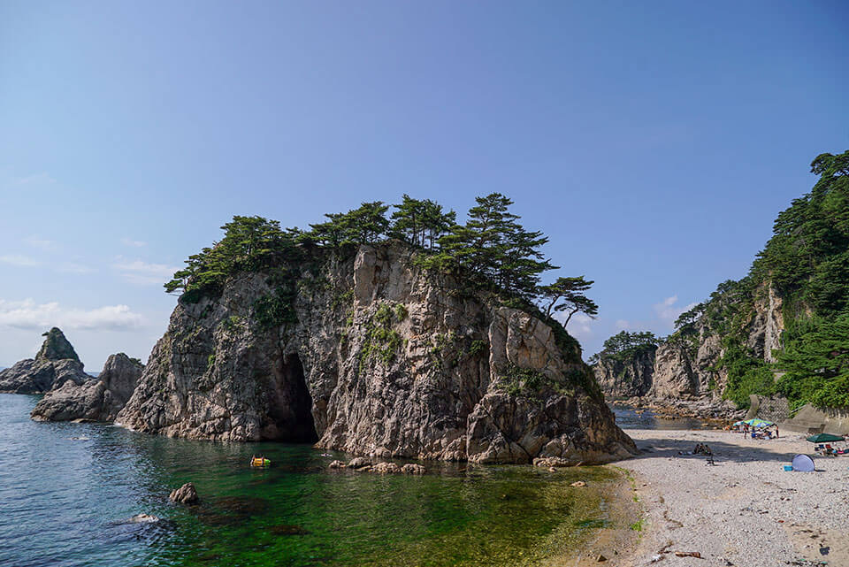
This beautiful 11 kilometer coastline is home to Niigata Prefecture Natural Park and many of the country’s protected natural spots. Due to corrosion from the Sea of Japan’s rough seas, many fascinating cliffs, caves, and other rocks have been and continue to form along the coast. The fast tidal current due to there being no nearby river gives the ocean water it’s attractive clear waters.
Wrapped in Mountain Greenery
From the spiritual Dewa Sanzan Mountains, to the highest peak in Yamagata, Mt. Chokai, the Kira Kira Uetsu Tourist Area has many breathtaking mountains that can purify both your body and spirit. Feel nature’s energy course through your body as you walk the paths famous haiku poet Matsuo Basho once travelled.
.jpg)

Mt. Chokai - Nikaho, Akita Prefecture / Yuza & Sakata, Yamagata Prefecture
With an elevation of 2,236 meters, this mountain is the tallest in Yamagata Prefecture and is counted as one of the top 100 mountains and scenic views in Japan. Here you can see a variety of nationally protected species of plants and bodies of water.
Mt. Gassan - Tsuruoka / Shonai, Yamagata Prefecture
Trekking while viewing alpine greenery or fall leaves, and summer skiing in the year-round snow slopes are just one of many activities to be enjoyed throughout the year at Mt. Gassan, also selected as one of the top 100 mountains of Japan.
Mt. Yudono - Tsuruoka, Yamagata Prefecture
Along with Ise and Kumano, this mountain is one of the top three sacred places in Japan. Mt. Yudono Shrine, considered the most holy of the Dewa Sanzan shrines, is famous for its strict no photos, no shoes policy. The Shugendo ground is also considered so sacred that one is neither to talk nor hear of what happens inside the shrine.
Rokujuri-goe Highway - Tsuruoka, Yamagata Prefecture
This historic road between Yamagata and the Sea of Japan has been used since long ago by travelers headed for Mt. Yudono. Back in the Edo period the road flourished as a stop along the way to Yudono. Traditional rural thatched roof houses from the period still exist today in the town of Tamugimata.
Dewa Highway - Tsuruoka, Yamagata Prefecture / Murakami, Niigata Prefecture
This mountain road runs between the castle town of Murakami, Niigata and Tsuruoka, Yamagata. Many old fashioned inns and prominent family residences still remain today. The road is also known to be once used by haiku poet Matsuo Basho.
Haguro Road - Tsuruoka, Yamagata Prefecture
Mt. Haguro, one of the three spiritual Dewa Sanzan mountains, has a stone step road lined with cedar trees that are estimated to be over 300 years old. Included along the path is the historic Five Storied Pagoda. The road was awarded three stars in Michelin's Green Guide.
Genso no Mori - Tozawa, Yamagata Prefecture
The 1,000 year old giant cedar tree located here, which has a trunk with a circumference of over 15 meters, is a popular photo spot. The giant tree has several branches growing from one root that stretch out toward the sky. This mysterious forest will change your image of cedar trees forever.
[Traffic Information] Tsuchiyuzawa Forest Road Closed
Due to a large-scale collapse of the forest road caused by the heavy rains in July 2024, the road is currently closed.
We are coordinating with relevant authorities for restoration, but there is currently no prospect for reopening.
We will inform you as soon as a reopening date is decided.
Nihonkoku - Murakami, Niigata Prefecture
This mountain (height of 555 meters) separates Niigata and Yamagata prefectures and is located in a drainage divide*. In the past, Omata Village located at the bottom of the mountain was a inn town for Dewa Sanzan travellers, and its elegant inn town charm still shines today. *A drainage divide is the line that separates neighbouring drainage basins into opposite directions. This mountain serves as that divide, causing rainfall to drain into rivers and oceans on both sides of the mountain.
Kousagizan - Sekikawa, Niigata Prefecture
When Ino Tadataka created the first map of Japan, it is said that he used Kousagizan as the basis of his surveys. There are many fans of this perfectly triangle shaped mountain and its rabbit shaped snow formation that appears near its summit during snowy seasons.
Streams and Springs Trip
In 2008 the National Environment Agency created a “Heisei Period Top 100 Waters” list, picking the top 100 springs, rivers, and underground water sources in the country. Many streams and springs on the list are located in this region. The rain and snowfall on Mt. Chokai, Dewa Sanzan, and Asahi Mountain ranges all eventually returns to the rivers and ocean in the area, creating naturally clean waters that relax you just by looking at them.


Shishigahana Marsh - Nikaho, Akita Prefecture (Heisei Period Top 100)
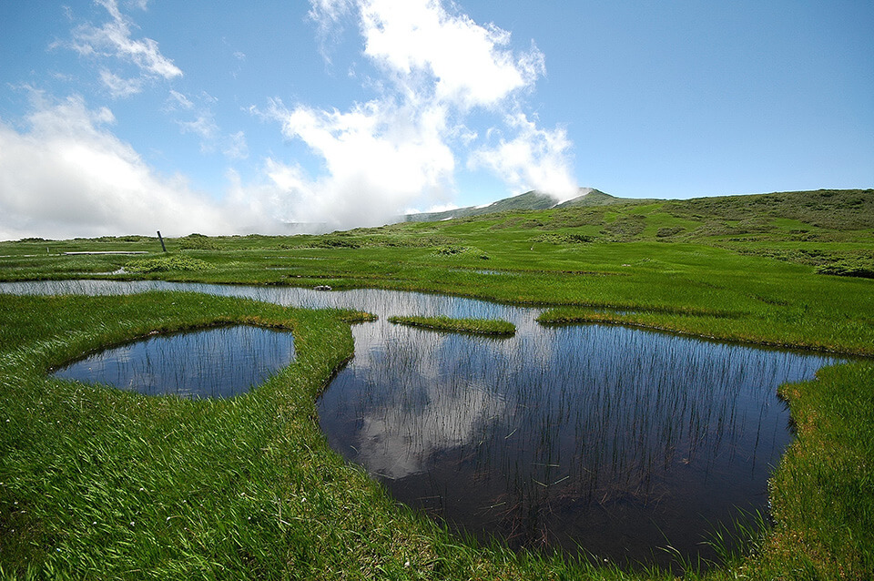
There are 10 spots from which Mt. Chokai’s subterranean waters flow, including the spring pond called “Detsubo”, in this 26 hectare wide marshland which is a nationally protected natural monument.
Dohara Falls - Yuza, Yamagata Prefecture
Dohara’s name comes from the way Mt. Chokai’s subterranean streams gush out of the hillside. The falls are also revered as the location where the god of safe childbirth resides. There are two waterfalls located next to each other, and it is said that each fall’s water has its own taste.
Ushiwatari River - Yuza, Yamagata Prefecture
The crystal clear water of the Ushiwatari River flow from Mt. Chokai’s subterranean streams. The baikamo plants found here can only grow in clear streams, and in early summer the plants bloom small white flowers.
Maruike Pond - Yuza, Yamagata Prefecture
This mysterious 20 meter emerald green pond gets its sole source of water from underground streams. The pond itself is revered as a god, and is loved and respected by the locals.
Tamasudare Falls
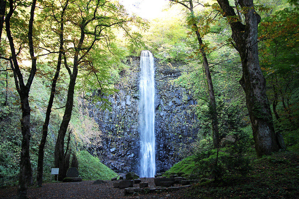
With a length of 63 meters, and a width of 5 meters, this waterfall wins the ranking of highest waterfall in Yamagata Prefecture. The waterfall gets its name from the way the sun hits a traditional tamasudare woven screen. In spring and summer, the falls are lit up, creating a magical scene.
Mototaki Fukuryusui Underflow - Nikaho, Akita Prefecture (Heisei Period Top 100)
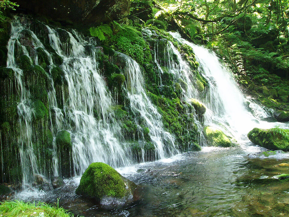
The Mototaki Fukuryusui Underflow is where Mt. Chokai’s subterranean waters pour out from a 30 meter wide rock surface. The green moss covering the rock’s surface and the white mist from the falls create an elegant scene.
Tachiyazawa River - Shonai, Yamagata Prefecture (Heisei Period Top 100)
Mt. Gassan’s underground streams are interwoven into 113 different bodies of water and are some of the country’s cleanest. This river is historically known to have contained gold dust, and was where the Shonai Domain set up a gold mining excavation site in the Edo period.
Shiraito no Taki - Tozawa, Yamagata Prefecture
There are many waterfalls located in the 300 to 500 meter tall mountainous region along the Mogami River, but Shiraito no Taki is the largest. Its name, Shiraito, literally means “white thread”, and comes from the sight of the water falling, which looks like white threads.
Nanatsu Falls - Tsuruoka, Yamagata Prefecture
This 90 meter tall waterfall is comprised of several falling streams that merge together on the way down. If you climb up the nearby hill to Bandai-Asahi National Park’s stone monument, you can see the whole waterfall from the nearby Nanatsu Falls Park unobstructed.
Kichijoshimizu - Murakami, Niigata Prefecture (Heisei Period Top 100)
In 1924, 38 villagers from Daimai Village drew water from the foot of Mt. Kichijodake to use for drinking. Ever since then, the water has been carefully controlled, maintained, and used carefully in everyday life. It’s also used to make local sake that can only be obtained in this area.
Arakawa River - Murakami / Sekikawa (Heisei Period Top 100)
This river ranked top on river water quality lists for three years in a row from 2003 to 2005. Many families visit the Arakawa River from outside the prefecture to enjoy some rest and relaxation while fishing for sweetfish, salmon, and sculpin fish.
Mt. Chokai and Tobishima Island Geopark
The Mt. Chokai and Tobishima Island Geopark is recognized as an area that advances the protection and use of Japan’s geological heritage. As of April 2018, there are 34 areas recognized as geoparks in Japan.
*Geoparks are natural parks that include several geological heritages, such as strata, rocks, volcanoes, and other geological features. It is a place to look at mountains and rivers and consider how everything came to be, ecosystems, and people’s way of living. A geopark is a place to think about the earth in its entirety.
Click here for more details.